background

Command Control Station

Product
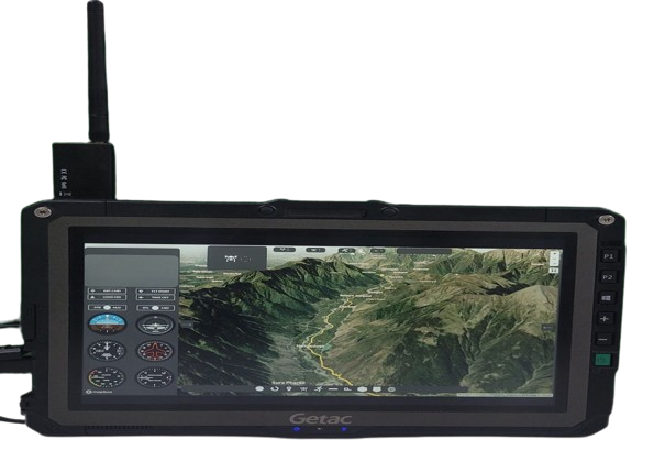
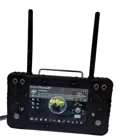
1. Edge GCS - Aerial
  • Features a specialised Geographic Information System (GIS) engine for tailored aerial mapping.
  • Equipped with advanced capabilities for precise mission mapping in aerial scenarios.
  • Includes swap control features for seamless transitions between different modes or components, enhancing operational adaptability.
  • Capable of analyzing flight traffic patterns for improved airspace management.
  • Provides On-Screen Display (OSD) visual overlays and various advanced features for comprehensive situational awareness.
  • Experience the future of aerial mapping and control with the Edge GCS—your solution for advanced features in aerial missions. Stay tuned for more details as this cutting-edge technology is coming soon.
  • Mapping Interface Options:

  • Offers versatile mapping interfaces, including
  • Defence Series for military applications
  • Open Series for flexibility and compatibility
  • Satellite Mapping for comprehensive aerial mapping

  • 2. Edge GCS - Land
  • Offers full configurability and cross-platform compatibility for versatile and adaptable operations on land.
  • Features a specialised Geographic Information System (GIS) engine for tailored mapping and geospatial analysis on land.
  • Includes swap control features, allowing seamless transitions between different modes or components for enhanced operational adaptability.
  • Provides On-Screen Display (OSD) visual overlays and various advanced features for comprehensive situational awareness during land operations.
  • Enables configuration of mapping parameters to suit specific land-based mission requirements.
  • Experience the power of the Edge GCS - Land, a configurable and cross-platform solution designed for advanced land-based operations. Stay tuned for more details as this cutting-edge technology is coming soon.

  • Contact for details